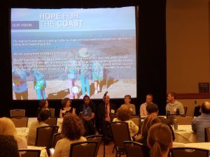
The State of California’s 4th Climate Change Assessment was recently released and the news is not great. The Assessment predicts more heat waves, more wildfires, faster sea level rise and a staggering price tag. Notably, 31 to 67 percent of Southern California beaches may completely vanish by 2100 without large-scale human interventions. The key findings of the Assessment were unveiled last week at the 2018 California Adaptation Forum (CAF18). Surfrider Foundation’s California Policy Coordinator Mandy Sackett attended to learn about the latest on climate change science and adaptation efforts across the state. Below is her report and suggestions for how you can get involved:
CAF18 was a lively, dynamic conference held in Sacramento from Aug. 27 to Aug. 29. Debates ensued over strategies to address and adapt to climate change, how to do it in a socially and environmentally equitable way and who should pay for it. While those debates are ongoing, the conversation nonetheless advanced.
Sea Level Rise Planning Tools
In California, science-based guidance is being used across the state and resources are being provided to local and tribal governments to help with planning for sea level rise. Throughout the conference, state agency representatives shared their perspective on planning and updates on the latest guidance. Additionally, a plethora of new planning tools are now available and several were unveiled for the first time at the Forum:
- The Ocean Protection Council introduced their updated 2018 California Sea Level Rise Guidance, which includes a risk analysis decision framework to help project planners prepare for sea level rise.
- Robert Lempert, of RAND Corp., expanded on the emerging state tool known as “adaptation pathways,” which allows decision makers to consider multiple sea level rise scenarios when making management decisions and re-evaluate to maximize future flexibility.
- The California Coastal Commission discussed their 2018 Sea Level Rise Guidance update, which contains new references to best available science and gave examples of low risk aversion planning and permitting decisions (public access, floating docks, temporary structures), medium-high risk aversion (residential), and extreme risk aversion (critical infrastructure).
- NOAA (with other partners) introduced a publication, “Coastal Hazard Resilience Planning in California,” a new resource to help local governments plan for sea level rise.
- Point Blue Conservation Science gave a preview of an exciting new sea level rise viewer, Our Coast, Our Future, which expands USGS CoSMoS viewer to the Bay Area.
- The Bay Conservation and Development Commission gave an overview of the Adapting to Rising Tides Bay Shoreline Flood Explorer, which is designed to help Bay Area Communities plan for current and future flooding driven by sea level rise, tides, and storm surge.
- University of California Berkeley described Cal-Adapt, a new planning tool that has been used primarily by the energy sector, and enhancements to the sea level rise viewer.
- The Office of Planning and Research introduced the new Adaptation Clearinghouse website, a database containing searchable documents and resources useful for adaptation planning.
Bottom Line
We need to plan for different possible sea level rise scenarios using science based planning tools. Resilience, adaptability and collaboration will be the keys to success.
Takeaways
 Climate resilience and equity leaders coming together to address community vulnerabilities to climate impacts and regional climate justice work.
- Your input is needed. California is planning for sea level rise at all levels of government. Guidance from state agencies will help communities become more resilient and protect natural resources. Public participation in local planning efforts is vital to preserve our beaches, recreational opportunities and coastal resources. Too often, local governments only hear from ocean front homeowners, developers and others with an interest in protecting private property.
- Planning must be inclusive. While the uncertainty of climate change impacts is challenging for decision-makers, one idea is to shift from ‘stakeholders’ involvement to ‘asset defenders’, which includes having everyone at the table at early planning stages – including the public and inland communities.
- Tribal input should not be an afterthought. All of California’s land must be acknowledged as ancestral land, whether or not it belongs to a tribe today. We must better incorporate traditional knowledge as foundational, not as a token voice or afterthought in planning.
- All adaptation planning must be equitable. Decision-making should include strong community engagement. We must recognize that residents are experts on their communities. Residents can help to implement climate-smart infrastructure principles of planning proactively, holistically, and transparently.
- The time is now. Natural disasters are going to be more frequent and more intense as we have already seen in the last two years alone. What are we waiting for?
We look forward to advancing climate change adaptation planning in California. Reach out to your local chapter to find out how you can get involved in planning in your community! For more information on the forum, click here.


